
The Newest Kind of Dive Site Map
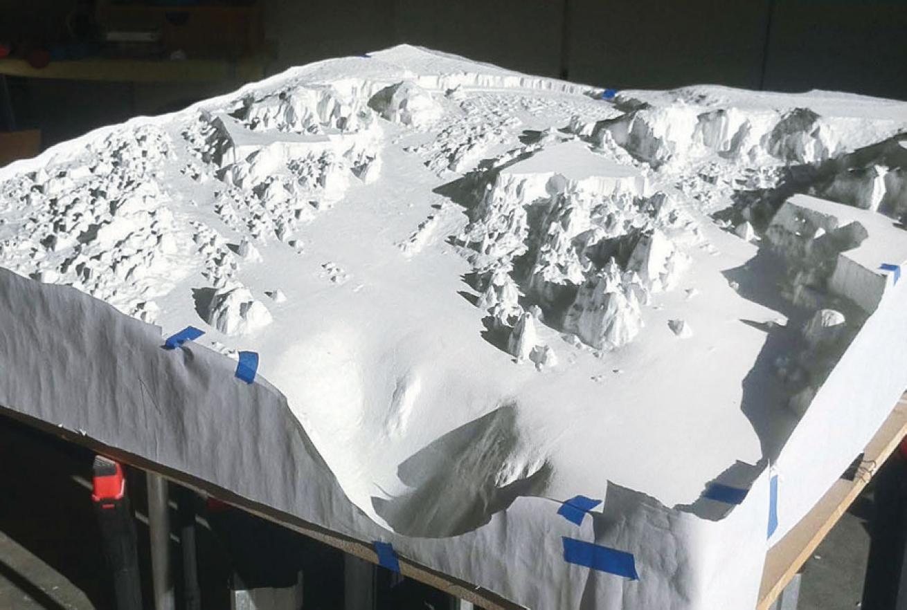
When California divers want to explore an underwater wilderness, they head to Point Lobos State Marine Reserve. The geological history of this section of rugged Pacific coast can be traced over the past 80 million years. Some of the oldest rocks divers see here were formed during the Cretaceous Period, when Tyrannosaurus rex roamed the Earth and fierce mosasaurs reigned in the sea.
The spectacular landscape continues underwater, as if mountains were shaken into the Pacific. “Imagine knife-edge structures as tall as skyscrapers, giant pinnacles undamaged by the erosion of their land-based counterparts, chasms barely wide enough to swim through and ledges dropping into unfathomable depths,” says Anna Patterson, Point Lobos Foundation’s development and communications director. “The topography that was above water during the last ice age is preserved much as it might have looked thousands of years ago.”
The reserve encompasses 550 land acres, and its protected underwater area is more than 18 times that size at 9,907 acres.
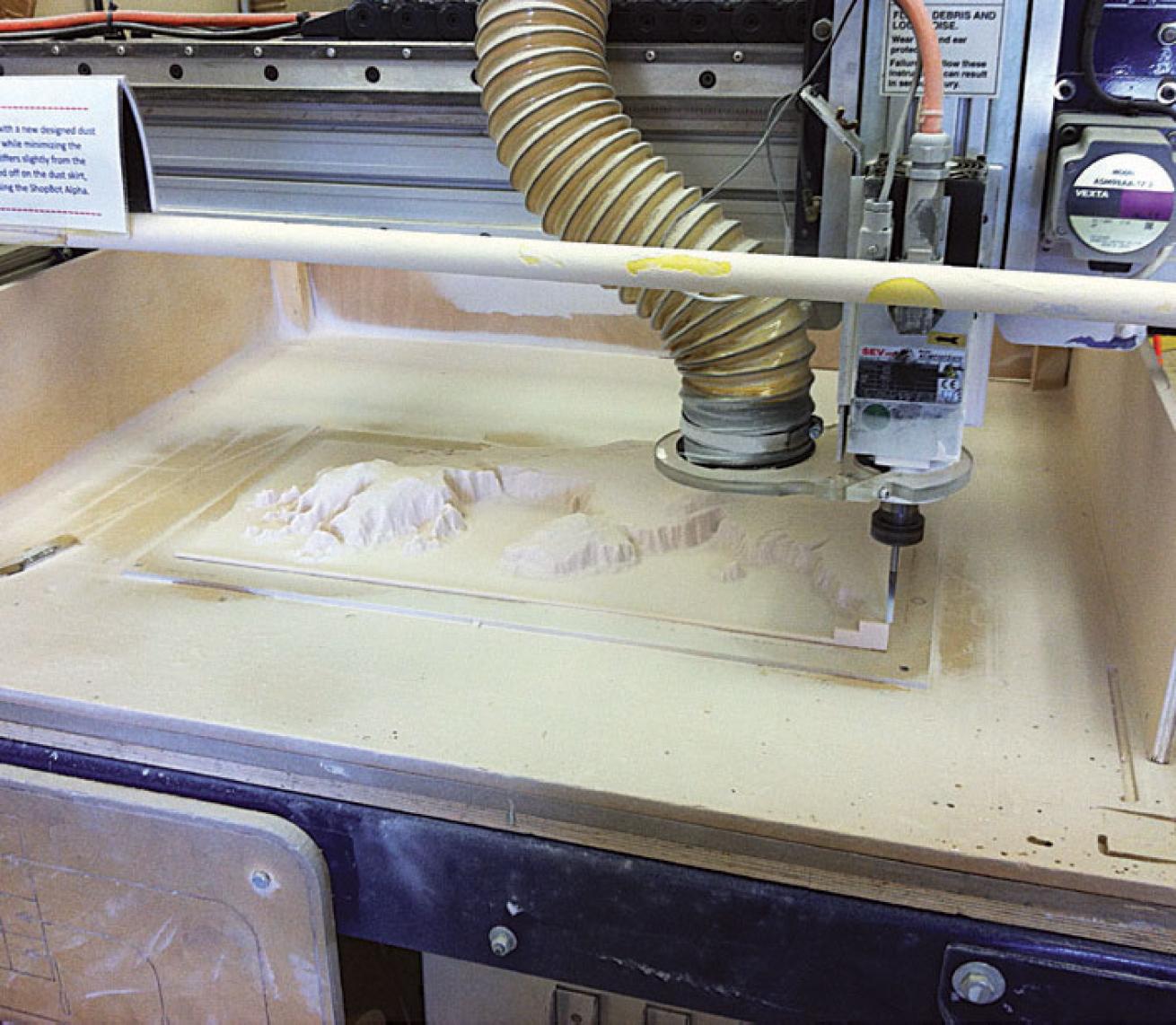
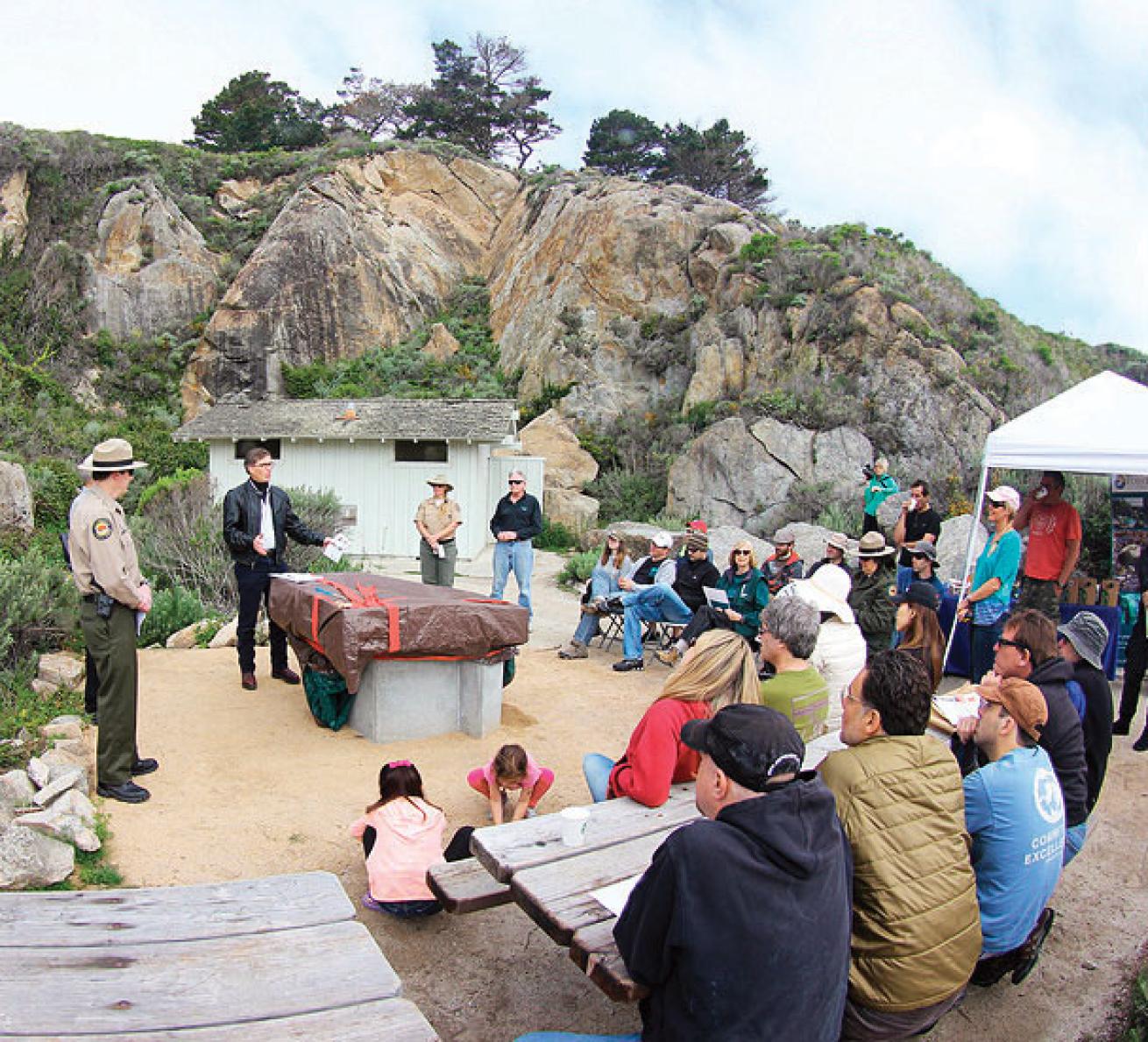
Thanks to the efforts of divers from Bay Area Underwater Explorers and the Central California Council of Diving Clubs, this dramatic underwater terrain has been brought to life with a 3-D model installed at Whalers Cove. The 800-pound concrete model and supporting maps showcase every pinnacle, canyon and chasm in remarkable detail.
“This has been a labor of love for me,” says Gary Banta, a semiretired Silicon Valley entrepreneur and member of BAUE. “I invested 1,500-plus hours to bring this model to Point Lobos.”
The project began with improving on existing maps that were fuzzy, inaccurate and incomplete. In 2010, more than two dozen BAUE divers spent three days in 44-degree water manually mapping a section of the ocean floor, using knotted and numbered lines to coordinate depth measurements in a grid pattern.
This hands-on approach, however, was impractical for mapping the entire reserve. So Banta raised money to secure the use of California State University at Monterey Bay’s Kelpfly, a jet-ski-based, multibeam sonar platform. Using Kelp- fly, it was possible to map the entire area at a 1-meter resolution. The resulting high-res data set made it possible to create the 3-D model. Banta also developed an interpretative sign for park visitors.
“This protected reserve offers one of the richest marine habitats in California and stunning underwater structures,” says Banta. “My hope is that this model will be a window to this stunning reserve, allowing generations of visitors to experience its wonders.”
_Photos: __CLOCKWISE: The assembled master model, Gary Banta; machining one of 28 pieces, Gary Banta; 800-pound final 3-D model under wraps before the ribbon-cutting, Ted Heublein._